Heading down the Trinity Bay side of the Baccalieu Trail we ran upon several interesting town names. There’s Heart’s Content, Heart’s Desire, and Heart’s Delight, all believed to be named after fishing vessels that fished out of these harbors during the seventeenth and eighteenth centuries.
We also noticed that just about every town had a SUF Lodge. In Heart’s Content, the SUF Lodge #1 is a registered Heritage Structure. This structure was built by the original Society of United Fishermen. The Society was founded in 1862 by Rev. George Gardener, a Church of England clergyman. It provided sickness and death benefits for fishermen and their families. Other locals adopted the basic design of the building. The triangular shape window is the symbol of the society and can be seen on many SUF Halls throughout Newfoundland. Also in Heart’s Content was a beautiful red and white candy stick light house.
There’s a nice variety of homes in this area, from the traditional to the brand new. Many of the old clapboard homes, have been refurbished with siding, but occasionally we still run across a few of the weather-beaten ones. Though it seems the locals are getting away from the brightly painted homes
 and now going more with pastels and naturals, we love to see those bold colors. Of course, there is nothing like the salt-box or biscuit box house with the white picket fence to make your mind
  wander toward the romance novels of Ireland.
A short piece down the highway, we came to Shag Rock. The large triple-horned rock, jutting sharply out of the water near shore, is called the “Shipwrecker” and is a reminder of the dangers of the sea. While taking a picture, we spotted a beach and climbed down to it.
 George found a new walking stick, but McKenzie and I persuaded him to leave it behind.
 All of us took a turn dipping our tootsies in the cold, cold water.
 McKenzie was definitely not in the mood for walking in icy cold water on a cloudy day.
You just never know what you will see around the next bend or over the next hill as we found out in Whiteway, when we came upon the townspeople joining in for a Walk-a-thon down the middle of the road; or the gorgeous blue of the sea as we headed to the Burin Peninsula, via the Heritage Run Trail.
  This is an entirely different part of Newfoundland both in geography and outlook. The Burin Peninsula is surrounded by panoramic maritime barrens with many ponds.
 Here you will see hawks, barren land birds, and migratory caribou in addition to moose. Speaking of moose, this is the only one we’ve seen thus far.
  Though we don’t want to meet one on the road, we are still looking hard to see our first real moose. I think we are getting close, though, because we did see a weasel!
We spent our first two nights in Marystown, dropped our trailer at the information center and drove the truck over to Burin, which is built along a series of high cliffs and sheltered coves . Once a haven for pirates and privateers, Captain James Cook was sent here to set up a lookout to catch smugglers running rum and other booty from Saint-Pierre.
The Oldest Colony Trust Building at the end of the Boardwalk, was built in 1933 as an industrial freezer for the nearby fish plant. This 100 foot long building is currently used as an arts and culture center where citizens congregate to socialize and celebrate their shared cultural heritage. The view from the boardwalk is breathtaking as you stroll along the shoreline.
 As we were walking, George spotted a live starfish in the crystal clear water beside the boardwalk.
 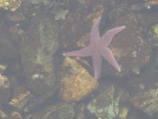 It is so calm and serene here, it is hard to imagine the tragedy of 1929 when the town was hit by a great tidal wave created by a 7.2 earthquake in the ocean outside the harbor.
As we viewed the museum which had an extensive history on the tidal wave, we felt it could best be summed up by a letter written by one of the locals to his brother after the tragedy. “On November 20, 1929, at 5:20 p.m., we had an earth tremor. All the houses and ground shook for about five minutes. This put everyone in a panic, women screaming and praying and the men stood silent and scared. But we were just trying and partly succeeded in quieting the women, when we had a tidal wave of the worst kind. Enormous waves 20 feet high swept into the harbor on the other side. The harbor was cleared by the first wave, then the second came and brought it all in again. Such noise and scrunching you never heard. By this time we had all fled to the hills, the highest places we could find from there. We watched the third wave come and go. You could hear the poor humans who were caught screaming, women and men praying out loud. Oh God! Jack, it was terrible!” Twenty seven people lost their lives and there was many millions of dollars of devastation to the area.
Another story was of a telegraph operator who remained at her desk to keep the lines with other offices at Burin and Great Burin open until the waters swirled around her feet. Despite her apprehension, she returned to her office as soon as the waters subsided, around 11 p.m. The first message of the disaster to reach the outside world was sent by wireless from the Newfoundland Railways Boat, “Portia”. We drove to the other side of the harbor to find the spot where the tidal wave came in from the ocean and let our imagination run rampant. How horrible it must have been to see that wave approaching.
An additional tidbit of history that we gathered at the museum was regarding a merchant marine ship which sailed into the harbor in 1835 and dropped anchor at Jersey Room. The captain and the crew were infected with smallpox. Though the townspeople refused to let them come ashore, the ship stayed in the harbor until the captain and crew died. Only then did the townspeople board the ship to remove the bodies. The captain and his crew were buried in a mass grave in a grassy meadow adjacent to the harbor. Now you would think that this event would have some kind of marker so curious people like us could find the place, so off we went on a tiny uphill road just barely big enough for our truck, with cliffs dropping down to the harbor on one side and granite cliffs raising to the sky on the other. We finally found just a little sign saying “Jersey Room”, took a picture, and ended up backing all the way down the winding road. What we won’t do to try to bring you factual history thru pictures and documentation!!!!
Our last stop in Burin was the Burin Heritage House which was formerly a residence built in 1920-22 by Vincent Reddy, a local shopkeeper. It is the only Queen Anne style house left in Burin with rooms decorated as they would have been at that time.
Tomorrow we will hitch up and continue “driving the boot” as the locals say. (The peninsula is in the shape of a boot). I’m sure we’ll find more surprises just around the corner. We are finding that a lot of the places are starting to close up for the winter as this area is not really a big tourist draw except for the summer months when people want to go the French Island of St. Pierre. Once finished with this peninsula, we will head up to the northeast and take a trip around the Discovery Trail of the Bonavista Peninsula. We’re hoping that most of the sights there will still be open. If not, we are still seeing some beautiful, unspoiled country, so we hope you are enjoying the trip thus far and will stick with us to see what is coming up next. Til then, take care and enjoy life!
We also noticed that just about every town had a SUF Lodge. In Heart’s Content, the SUF Lodge #1 is a registered Heritage Structure.
This structure was built by the original Society of United Fishermen. The Society was founded in 1862 by Rev. George Gardener, a Church of England clergyman. It provided sickness and death benefits for fishermen and their families. Other locals adopted the basic design of the building. The triangular shape window is the symbol of the society and can be seen on many SUF Halls throughout Newfoundland. Also in Heart’s Content was a beautiful red and white candy stick light house. There’s a nice variety of homes in this area, from the traditional
to the brand new. Many of the old clapboard homes, have been refurbished with siding, but occasionally we still run across a few of the weather-beaten ones. Though it seems the locals are getting away from the brightly painted homes and now going more with pastels and naturals, we love to see those bold colors. Of course, there is nothing like the salt-box or biscuit box house with the white picket fence to make your mind wander toward the romance novels of Ireland.A short piece down the highway, we came to Shag Rock.
The large triple-horned rock, jutting sharply out of the water near shore, is called the “Shipwrecker” and is a reminder of the dangers of the sea. While taking a picture, we spotted a beach and climbed down to it. George found a new walking stick, but McKenzie and I persuaded him to leave it behind. All of us took a turn dipping our tootsies in the cold, cold water. McKenzie was definitely not in the mood for walking in icy cold water on a cloudy day.You just never know what you will see around the next bend or over the next hill as we found out in Whiteway, when we came upon the townspeople joining in for a Walk-a-thon down the
middle of the road; or the gorgeous blue of the sea as we headed to the Burin Peninsula, via the Heritage Run Trail. This is an entirely different part of Newfoundland both in geography and outlook. The Burin Peninsula is surrounded by panoramic maritime barrens with many ponds. Here you will see hawks, barren land birds, and migratory caribou in addition to moose. Speaking of moose, this is the only one we’ve seen thus far. Though we don’t want to meet one on the road, we are still looking hard to see our first real moose. I think we are getting close, though, because we did see a weasel!We spent our first two nights in Marystown, dropped our trailer at the information center and drove the truck over to Burin, which is built along a series of high cliffs and sheltered coves
. Once a haven for pirates and privateers, Captain James Cook was sent here to set up a lookout to catch smugglers running rum and other booty from Saint-Pierre.The Oldest Colony Trust Building at the end of the Boardwalk, was built in 1933 as an industrial
freezer for the nearby fish plant. This 100 foot long building is currently used as an arts and culture center where citizens congregate to socialize and celebrate their shared cultural heritage. The view from the boardwalk is breathtaking as you stroll along the shoreline. As we were walking, George spotted a live starfish in the crystal clear water beside the boardwalk. It is so calm and serene here, it is hard to imagine the tragedy of 1929 when the town was hit by a great tidal wave created by a 7.2 earthquake in the ocean outside the harbor.As we viewed the museum which had an extensive history on the tidal wave, we felt it could best be summed up by a letter written by one of the locals to his brother after the tragedy. “On November 20, 1929, at 5:20 p.m., we had an earth tremor. All the houses and ground shook for about five minutes. This put everyone in a panic, women screaming and praying and the men stood silent and scared. But we were just trying and partly succeeded in quieting the women, when we had a tidal wave of the worst kind. Enormous waves 20 feet high swept into the harbor on the other side. The harbor was cleared by the first wave, then the second came and brought it all in again. Such noise and scrunching you never heard. By this time we had all fled to the hills, the highest places we could find from there. We watched the third wave come and go. You could hear the poor humans who were caught screaming, women and men praying out loud. Oh God! Jack, it was terrible!” Twenty seven people lost their lives and there was many millions of dollars of devastation to the area.
Another story was of a telegraph operator who remained at her desk to keep the lines with other offices at Burin and Great Burin open until the waters swirled around her feet. Despite her apprehension, she returned to her office as soon as the waters subsided, around 11 p.m. The first message of the disaster to reach the outside world was sent by wireless from the Newfoundland Railways Boat, “Portia”. We drove to the other side of the harbor to find the spot where the tidal wave came in from the ocean and let our imagination run rampant. How horrible it must have been to see that wave approaching.
An additional tidbit of history that we gathered at the museum was regarding a merchant marine ship which sailed into the harbor in 1835 and dropped anchor at Jersey Room. The captain and the crew were infected with smallpox. Though the townspeople refused to let them come ashore, the ship stayed in the harbor until the captain and crew died. Only then did the townspeople board the ship to remove the bodies. The captain and his crew were buried in a mass grave in a grassy meadow adjacent to the harbor. Now you would think that this event would have some kind of marker so curious people like us could find the place, so off we went on a tiny uphill road just barely big enough for our truck, with cliffs dropping down to the harbor on one side and granite cliffs raising to the sky on the other. We finally found just a little sign saying “Jersey Room”, took a picture, and ended up backing all the way down the winding road. What we won’t do to try to bring you factual history thru pictures and documentation!!!!
Our last stop in Burin was the Burin Heritage House which was formerly a residence built in
1920-22 by Vincent Reddy, a local shopkeeper. It is the only Queen Anne style house left in Burin with rooms decorated as they would have been at that time.Tomorrow we will hitch up and continue “driving the boot” as the locals say. (The peninsula is in the shape of a boot). I’m sure we’ll find more surprises just around the corner. We are finding that a lot of the places are starting to close up for the winter as this area is not really a big tourist draw except for the summer months when people want to go the French Island of St. Pierre. Once finished with this peninsula, we will head up to the northeast and take a trip around the Discovery Trail of the Bonavista Peninsula. We’re hoping that most of the sights there will still be open. If not, we are still seeing some beautiful, unspoiled country, so we hope you are enjoying the trip thus far and will stick with us to see what is coming up next. Til then, take care and enjoy life!
1 comment:
That cute little white house behind the picket fence is a "Biscuit Box" house, a style unique to Newfoundland. A Saltbox has a steeper roof and is 2 storeys high in front, one storey in back; see http://www.heritage.nf.ca/society/saltbox/class.html
Post a Comment