We felt a slight tinge of regret as we pulled out from Pippy Park in St. John’s. So much had happened since we had arrived on August 20th and all of us, especially McKenzie, felt like we were leaving newly found friends much too soon, but the road is calling. We headed down the Admiral’s Coast which winds along Route 60 following the western and southern shore of Conception Bay. This region is a study in contrasts. The rocky harbors and bays contrast with the idyllic rural communities which are among the best farming areas in the province. There were vegetable stands all along the highways with beautiful lettuce, cabbage, turnips, potatoes, carrots, and greens. We just couldn’t pass them up!
Holyrood is a peaceful and scenic town located at the bottom of Conception Bay. They had a boardwalk beginning at the center of town and running to the beach, suitable for casual strolls. I dipped my toe in Conception Bay and decided it was much too cold for any further part of my anatomy. Across the street is George Cove Mountain which has an illuminated cross on the top of it. The present cross replaced a wooden one erected by appreciative American Service personnel who frequented Holyrood during World War II.
  After the wooden cross was blown away in a fierce northwesterly gale, the town erected a steel framed one to celebrate “Come Home Year” in 1966.
Further down the road, we came upon Harbour Main which has a local swimming pool, known as “The Tide”. Not quite like the pools we are used to, but I’m sure it is just as effective on a hot summer day.
We had read about the “disappearing church” in Avondale and it piqued our interest. Sure enough, as you come over the ridge you see the church, however, as you continue to drive on into the town, you lose it completely because of the lay of the land, until it pops up right in front of you. It must be magic and I couldn’t resist taking a picture of it once we saw it again. The Railway Station in Avondale was built by the Anglo-Newfoundland Telegraph Company, in either 1870 or 1880 and is the oldest surviving railway station in the province. Beside the station, an engine and several cars from the railway are displayed. In 1989, the Avondale residents sat on the tracks, refusing to let the workers take up the rails near the station.
 This is the only remaining section of main line track from the Newfoundland Railway. George and McKenzie took a breather on the Avondale Express while waiting for me to take pictures.
We know we’ve shown you a couple of pictures of small or biscuit box style homes, but we thought you’d also like to see some of the larger homes in the area of Conception Harbor. This one comes with its own yacht!
Leaving the Admiral’s Coast trail, we are now driving on the Baccalieu Trail. The name “Baccalieu Trail” pays tribute to the thousands of fishermen whose names have not been recorded in history, but whose hard work and adventures have contributed to the European settlement of North America. Today, the Baccalieu region is responsible for approximately 22% of the value of the provincial fishery. The region is comprised of almost 60 small towns which retain their peaceful community centered lifestyle and which follow the coast on the north shore of Conception Bay and the south shore of Trinity Bay.
Our first stop was Brigus which is often compared to an old English town with its many rock walls, old style architecture, lush gardens and winding, very narrow roads. After finally finding place to park our truck and trailer, we walked down the winding road to Hawthorne Cottage which was the home of Captain Robert Bartlett (1875 – 1946). We’ve all heard of Robert Peary but we had no idea who Captain Bob Bartlett was. Seems he prepared the way for Peary. In the polar expedition of 1908-09, Captain Bob, commanding the “Roosevelt”, not only broke a trail thru dense shifting packed ice, but established supply caches on the ice off northern Ellesmere Island to allow American explorer Robert Edwin Peary to make his celebrated “dash for the Pole”. Captain Bob was decorated and hailed worldwide as a great navigator and leader. During WWI, Captain Bob worked for the U.S. Army Transport Commission and during WWII, he and his famous schooner “Effie M. Morrissey” were commandeered by the U. S. Navy for hydrographic and supply work in Hudson Bay and Greenland. When he was not out exploring his beloved Arctic lands, he was much in demand as a writer, lecturer, speaker and movie-reel maker. The stories of his incredible exploits – of survival against impossible odds – of an unknown land and its inhabitants, flora and fauna, thrilled and delighted readers, listeners, and viewers the world over. His passion for Arctic exploration led him to make at least 20 voyages north, many for scientific organizations, museums, universities, and zoos, all devoted to expanding the knowledge of one of the last known frontiers in the world.
When Bartlett and his crew would stop in Brigus after an Arctic adventure, the town people were amazed to see Hawthorne’s gardens transformed into a mini zoo with musk oxen, walrus, and even a polar bear. When it was time to set sail to New York, his second home, Bartlett would load up the animals for delivery to American zoos.
Hawthorne cottage was built in 1830 in Cochranedale by John Leamon, Captain Bartlett’s maternal great-grandfather. The original square building lacked the bay windows, rear addition, and veranda that are visible today. In the winter of 1833-34, the cottage was hauled approximately 6 miles overland thru ice and snow on log rollers to its present location. It passed through the generations with various conditions of inheritance until Bartlett’s mother inherited it with a stipulation that it pass to her son. After he had achieved fame with Peary, Bob Bartlett spent most of his summers in the arctic and winters in New York. His parents, William and Mary Bartlett, and his sisters Emma and Eleanor became the permanent residents, although Bob made frequent visits on his way to and from the arctic.
The “Arctic” Room or parlor, was turned into a showcase of their brother’s memorabilia by the Bartlett women. The dining room/sitting room was a sunny room used by the family for many activities as well as meals. During the winter, a fire was kept going all day. The Bartlett women were accomplished musicians and entertained guests with songs and hymns around the piano. The radio was an important source of news and the family would gather around it when a broadcast from Captain Bob was expected.
Hawthorne Cottage was the first house in Brigus to have running water, which was supplied by a thirty foot gravity fed water tower.
After visiting the cottage, we walked around the delightful town which had a small, very English looking Bed and Breakfast. A walk behind the church and down by the seashore led us to “the Tunnel”.
  The Brigus Tunnel was built for Captain Abraham Bartlett by the Cornish miner, John Hoskins during the summer of 1860. Its purpose was to provide an easy access to the Bartlett wharf
  which projected into the deep water at its outer end. Since the holes into which the blasting charges were placed had to be drilled by hand, a special forge was constructed near the site for keeping the drills sharpened. The only explosive used was black gunpowder. The job was completed after four months of strenuous labor.
The winding, hilly roads were beginning to take their toll so we decided that Cupids would be our drycamping spot for the night. Cupids was settled in 1610 by John Guy. It is the oldest English colony in Canada and the second oldest English colony in North America. In 1610, the London & Bristol Company was formed to colonize Newfoundland, one of the very first attempts to establish an English colony in the New World. The first governor, John Guy, had made a previous voyage to Newfoundland and it was he who chose Cuper’s Cove (now Cupids) when the 39 colonists arrived in August of 1610. One of the colonists first tasks was to set to work cutting timber both to build their plantation and to load their vessel for the return voyage to England.
Guy sailed to England in the fall of 1611 and returned to Cupids in the spring of 1612. With him, he brought additional settlers (including artisans and 16 women). 62 people wintered at the colony that year. During the summer of 1612, the colony was plagued by pirates, particularly Peter Easton, who operated out of nearby Harbour Grace. The wife of colonist Nicholas Guie gave birth to a son on March 27, 1613 – the first recorded birth of an English child in Newfoundland and possibly the first in Canada.
In 1995, archaeologist, Bill Gilbert and his team began preliminary excavation of a site in Cupids which is the location of John Guy’s settlement. Since that time, digging has revealed a fireplace and building foundations plus about 100,000 artifacts dating back to the early 1600’s. We toured the archaeological dig and then the museum where the artifacts are housed. On display at the museum is the second largest Union Jack flag which was given by the British to celebrate the 300th anniversary of Cupids in 1910. (At that time, Newfoundland was not a province of Canada, but an independent country).
On our walk from the dig to the museum, we passed the Harley Hotel. I just happened to glance upwards and saw the chair perched on the widow’s peak. This was definitely a Kodak moment. After dinner, we took McKenzie for her evening constitutional
 and walked along the pier overlooking Conception Bay.
We awoke to a beautiful sunny morning with seagulls harmonizing with several other seabirds. After breakfast, we headed on down the Baccalieu Trail thru the peaceful and tranquil Clark’s Beach and into Spaniard’s Bay where we stopped to take a picture of some of the traditional rock walls. This particular wall was named “Lassy Wall” and was in front of the Anglican Church.
  It has an interesting history in that it was constructed by residents during the Great Depression who were paid with molasses.
Harbour Grace is one of the largest towns on the Baccalieu Trail. The Harbour Grace Air Field figured prominently in the history of Transatlantic flight. From 1927 – 1936, more than twenty flights took off from Harbour Grace to fly the Atlantic, some of them piloted by famous aviators such as Amelia Earhart who on May 20, 1932 became the world’s first woman pilot to fly solo across the Atlantic Ocean in a Lockheed Vega.
The “Spirit of Harbour Grace”, a DC-3 airplane was restored and donated to the town in 1993 to commemorate the town’s rich past in aviation.
The SS Kyle which is moored in the harbor, was built in 1913 and became the first boat to provide Labrador with a regular scheduled service.
We had read about a scenic coastline (developed) trail approximately ½ mile long which begins and the Church in Perry’s Cove. The road leading down was very narrow and twisting and we were hoping we wouldn’t meet another car as we were towing the trailer.
  We all needed to stretch our legs, so George, I and McKenzie walked the trail that ended at a lookout by the ocean. Along the way, we viewed a fully intact “root cellar” which dates back
  some 175 years. We also stopped at the Witches Rock which invited you to dip your fingers into
 the water. Both of us did but McKenzie was not too keen on putting here tootsies in for a dip. On windy days the “Blowhole” is a spectacular site. We saw it spouting but by the time I got close
 enough to take a picture, it had pretty well died out. Along the trail, we stopped and picked wild
 blackberries, blueberries and raspberries. Though it is almost at the end of their season, they were still very sweet and juicy and we both ate until we thought we’d better stop. What a refreshing and tranquil side trip.
We had debated about going to the very end of the tip of the peninsula, but decided to give it a try. The roads turned out to be pretty good and we were really glad that we took the extra hour or so to make the trip. Grates Cove is at the tip and is one of the closest points in North America to Europe. The distance by water from Grates Cove to Ireland is approximately 1,545 miles.
 Grates Cove rock walls,
 formerly used to wall vegetable gardens and keep out animals, are scattered throughout the community. The walls have been declared a National Historical Site.
Having decided it was time for “happy hour”, we pulled into the museum at Sibley’s Cove. George talked with a gentleman who lived behind the museum and he told us it was only open for special events. Since we wouldn’t be bothering anyone, we decided to spend the night here. After talking for a while, the gentleman went home but not before telling George that if we needed anything during the night, “just come on up to the house”.
We passed all types of homes today. I took a few pictures of them to give you an idea of how they look.
 Many are new, but there are still a lot of the old cottage type homes. As we move on, I’ll try to take some varied pictures as we spot them.
  Though Newfoundland is definitely progressive, they also cling to a lot of the old ways.
  The people are terribly friendly and many of the small villages have homes perched along the rugged cliffs, defying gravity.
 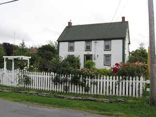 Lakes and ponds abound. Basins of peatmoss punctuate the berry barrens. Around every corner, there are streams and rivers, gullies and brooks and on their banks, a veritable park of “nature planted” bushes, shrubs, trees and flowers. It is truly the most beautiful place we have ever been.
There were vegetable stands all along the highways with beautiful lettuce, cabbage, turnips, potatoes, carrots, and greens. We just couldn’t pass them up!Holyrood is a peaceful and scenic town located at the bottom of Conception Bay. They had a boardwalk beginning at the center of town and running to the beach, suitable for casual strolls.
I dipped my toe in Conception Bay and decided it was much too cold for any further part of my anatomy. Across the street is George Cove Mountain which has an illuminated cross on the top of it. The present cross replaced a wooden one erected by appreciative American Service personnel who frequented Holyrood during World War II. After the wooden cross was blown away in a fierce northwesterly gale, the town erected a steel framed one to celebrate “Come Home Year” in 1966.Further down the road, we came upon Harbour Main which has a local swimming pool,
known as “The Tide”. Not quite like the pools we are used to, but I’m sure it is just as effective on a hot summer day.We had read about the “disappearing church” in Avondale and it piqued our interest. Sure enough, as you come over the ridge you see the church, however, as you continue to drive on into the town, you lose it completely because of the lay of the land, until it pops up right in front of you. It must be magic and I couldn’t resist taking a picture of it once we saw it again.
The Railway Station in Avondale was built by the Anglo-Newfoundland Telegraph Company, in either 1870 or 1880 and is the oldest surviving railway station in the province. Beside the station, an engine and several cars from the railway are displayed. In 1989, the Avondale residents sat on the tracks, refusing to let the workers take up the rails near the station. This is the only remaining section of main line track from the Newfoundland Railway. George and McKenzie took a breather on the Avondale Express while waiting for me to take pictures.We know we’ve shown you a couple of pictures of small or biscuit box style homes, but we thought you’d also like to see some of the larger homes in the area of Conception Harbor. This one comes with its own yacht!
Leaving the Admiral’s Coast trail, we are now driving on the Baccalieu Trail. The name “Baccalieu Trail” pays tribute to the thousands of fishermen whose names have not been recorded in history, but whose hard work and adventures have contributed to the European settlement of North America. Today, the Baccalieu region is responsible for approximately 22% of the value of the provincial fishery. The region is comprised of almost 60 small towns which retain their peaceful community centered lifestyle and which follow the coast on the north shore of Conception Bay and the south shore of Trinity Bay.
Our first stop was Brigus which is often compared to an old English town with its many rock walls, old style architecture, lush gardens and winding, very narrow roads. After finally finding place to park our truck and trailer, we walked down the winding road to Hawthorne Cottage
which was the home of Captain Robert Bartlett (1875 – 1946). We’ve all heard of Robert Peary but we had no idea who Captain Bob Bartlett was. Seems he prepared the way for Peary. In the polar expedition of 1908-09, Captain Bob, commanding the “Roosevelt”, not only broke a trail thru dense shifting packed ice, but established supply caches on the ice off northern Ellesmere Island to allow American explorer Robert Edwin Peary to make his celebrated “dash for the Pole”. Captain Bob was decorated and hailed worldwide as a great navigator and leader. During WWI, Captain Bob worked for the U.S. Army Transport Commission and during WWII, he and his famous schooner “Effie M. Morrissey” were commandeered by the U. S. Navy for hydrographic and supply work in Hudson Bay and Greenland. When he was not out exploring his beloved Arctic lands, he was much in demand as a writer, lecturer, speaker and movie-reel maker. The stories of his incredible exploits – of survival against impossible odds – of an unknown land and its inhabitants, flora and fauna, thrilled and delighted readers, listeners, and viewers the world over. His passion for Arctic exploration led him to make at least 20 voyages north, many for scientific organizations, museums, universities, and zoos, all devoted to expanding the knowledge of one of the last known frontiers in the world.When Bartlett and his crew would stop in Brigus after an Arctic adventure, the town people were amazed to see Hawthorne’s gardens transformed into a mini zoo with musk oxen, walrus, and even a polar bear. When it was time to set sail to New York, his second home, Bartlett would load up the animals for delivery to American zoos.
Hawthorne cottage was built in 1830 in Cochranedale by John Leamon, Captain Bartlett’s maternal great-grandfather. The original square building lacked the bay windows, rear addition, and veranda that are visible today. In the winter of 1833-34, the cottage was hauled approximately 6 miles overland thru ice and snow on log rollers to its present location. It passed through the generations with various conditions of inheritance until Bartlett’s mother inherited it with a stipulation that it pass to her son. After he had achieved fame with Peary, Bob Bartlett spent most of his summers in the arctic and winters in New York. His parents, William and Mary Bartlett, and his sisters Emma and Eleanor became the permanent residents, although Bob made frequent visits on his way to and from the arctic.
The “Arctic” Room or parlor, was turned into a showcase of their brother’s memorabilia by the Bartlett women.
The dining room/sitting room was a sunny room used by the family for many activities as well as meals. During the winter, a fire was kept going all day. The Bartlett women were accomplished musicians and entertained guests with songs and hymns around the piano. The radio was an important source of news and the family would gather around it when a broadcast from Captain Bob was expected.Hawthorne Cottage was the first house in Brigus to have running water, which was supplied by a thirty foot gravity fed water tower.
After visiting the cottage, we walked around the delightful town which had a small, very English looking Bed and Breakfast.
A walk behind the church and down by the seashore led us to “the Tunnel”. The Brigus Tunnel was built for Captain Abraham Bartlett by the Cornish miner, John Hoskins during the summer of 1860. Its purpose was to provide an easy access to the Bartlett wharf which projected into the deep water at its outer end. Since the holes into which the blasting charges were placed had to be drilled by hand, a special forge was constructed near the site for keeping the drills sharpened. The only explosive used was black gunpowder. The job was completed after four months of strenuous labor.The winding, hilly roads were beginning to take their toll so we decided that Cupids would be our drycamping spot for the night.
Cupids was settled in 1610 by John Guy. It is the oldest English colony in Canada and the second oldest English colony in North America. In 1610, the London & Bristol Company was formed to colonize Newfoundland, one of the very first attempts to establish an English colony in the New World. The first governor, John Guy, had made a previous voyage to Newfoundland and it was he who chose Cuper’s Cove (now Cupids) when the 39 colonists arrived in August of 1610. One of the colonists first tasks was to set to work cutting timber both to build their plantation and to load their vessel for the return voyage to England.Guy sailed to England in the fall of 1611 and returned to Cupids in the spring of 1612. With him, he brought additional settlers (including artisans and 16 women). 62 people wintered at the colony that year. During the summer of 1612, the colony was plagued by pirates, particularly Peter Easton, who operated out of nearby Harbour Grace. The wife of colonist Nicholas Guie gave birth to a son on March 27, 1613 – the first recorded birth of an English child in Newfoundland and possibly the first in Canada.
In 1995, archaeologist, Bill Gilbert and his team began preliminary excavation of a site in Cupids
which is the location of John Guy’s settlement. Since that time, digging has revealed a fireplace and building foundations plus about 100,000 artifacts dating back to the early 1600’s. We toured the archaeological dig and then the museum where the artifacts are housed. On display at the museum is the second largest Union Jack flag which was given by the British to celebrate the 300th anniversary of Cupids in 1910. (At that time, Newfoundland was not a province of Canada, but an independent country).On our walk from the dig to the museum, we passed the Harley Hotel.
I just happened to glance upwards and saw the chair perched on the widow’s peak. This was definitely a Kodak moment. After dinner, we took McKenzie for her evening constitutional and walked along the pier overlooking Conception Bay. We awoke to a beautiful sunny morning with seagulls harmonizing with several other seabirds. After breakfast, we headed on down the Baccalieu Trail thru the peaceful and tranquil Clark’s
Beach and into Spaniard’s Bay where we stopped to take a picture of some of the traditional rock walls. This particular wall was named “Lassy Wall” and was in front of the Anglican Church. It has an interesting history in that it was constructed by residents during the Great Depression who were paid with molasses.Harbour Grace is one of the largest towns on the Baccalieu Trail. The Harbour Grace Air Field figured prominently in the history of Transatlantic flight. From 1927 – 1936, more than twenty flights took off from Harbour Grace to fly the Atlantic, some of them piloted by famous aviators such as Amelia Earhart who on May 20, 1932 became the world’s first woman pilot to fly solo across the Atlantic Ocean in a Lockheed Vega.
The “Spirit of Harbour Grace”, a DC-3 airplane was restored and donated to the town in 1993 to commemorate the town’s rich past in aviation.
The SS Kyle which is moored in the harbor, was built in 1913 and became the first boat to provide Labrador with a regular scheduled service.
We had read about a scenic coastline (developed) trail approximately ½ mile long which begins and the Church in Perry’s Cove.
The road leading down was very narrow and twisting and we were hoping we wouldn’t meet another car as we were towing the trailer. We all needed to stretch our legs, so George, I and McKenzie walked the trail that ended at a lookout by the ocean. Along the way, we viewed a fully intact “root cellar” which dates back some 175 years. We also stopped at the Witches Rock which invited you to dip your fingers into the water. Both of us did but McKenzie was not too keen on putting here tootsies in for a dip. On windy days the “Blowhole” is a spectacular site. We saw it spouting but by the time I got close enough to take a picture, it had pretty well died out. Along the trail, we stopped and picked wild blackberries, blueberries and raspberries. Though it is almost at the end of their season, they were still very sweet and juicy and we both ate until we thought we’d better stop. What a refreshing and tranquil side trip.We had debated about going to the very end of the tip of the peninsula, but decided to give it a try. The roads turned out to be pretty good and we were really glad that we took the extra hour or so to make the trip.
Grates Cove is at the tip and is one of the closest points in North America to Europe. The distance by water from Grates Cove to Ireland is approximately 1,545 miles. Grates Cove rock walls, formerly used to wall vegetable gardens and keep out animals, are scattered throughout the community. The walls have been declared a National Historical Site. Having decided it was time for “happy hour”, we pulled into the museum at Sibley’s Cove. George talked with a gentleman who lived behind the museum and he told us it was only open for special events. Since we wouldn’t be bothering anyone, we decided to spend the night here. After talking for a while, the gentleman went home but not before telling George that if we needed anything during the night, “just come on up to the house”.
We passed all types of homes today.
I took a few pictures of them to give you an idea of how they look. Many are new, but there are still a lot of the old cottage type homes. As we move on, I’ll try to take some varied pictures as we spot them. Though Newfoundland is definitely progressive, they also cling to a lot of the old ways. The people are terribly friendly and many of the small villages have homes perched along the rugged cliffs, defying gravity. Lakes and ponds abound. Basins of peatmoss punctuate the berry barrens. Around every corner, there are streams and rivers, gullies and brooks and on their banks, a veritable park of “nature planted” bushes, shrubs, trees and flowers. It is truly the most beautiful place we have ever been.
No comments:
Post a Comment